


NASA releases horrifying El Niño satellite pics from 1997, 2015 and 2026
NASA releases horrifying El Niño satellite pics from 1997, 2015 and 2026

Allison Bloom Fri, October 23, 2026 at 4:55 PM UTC
9

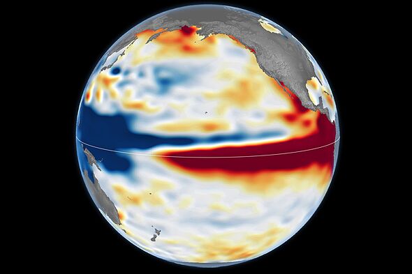
El Niño Then and Now (October 12, 2026) (Image: Maps by NASA Earth Observatory/Lauren Dauphin)
While El Niño events typically occur every two to seven years, the current climate phenomenon is developing into the most severe on record.
To track and compare their development, NASA published satellite imagery of the current build-up alongside earlier events from 1997 and 2015.
According to NASA, this year's event emerged far more rapidly than the one in 1997. It is projected to surpass the strength of both the 1997 and 2015 occurrences. Those previous heavyweights triggered severe droughts across southern Africa, wildfires in the Amazon and Indonesia, and coastal flooding in Southern California.
Killer earthquake flattens homes as enormous rescue mission launched
Ocean is changing color in terrifying event not seen since 1950
"[Satellites let] us look back in time and compare this El Niño to what happened in 1997," explained Josh Willis, project scientist for sea level missions at NASA's Jet Propulsion Laboratory. "And right now, this one is on track to be even bigger."
El Niño is a naturally occurring climate pattern that occurs every two to seven years, bringing warmer-than-average sea surface temperatures to parts of the tropical Pacific.
El Niño Then and Now (October 13, 1997) (Image: Maps by NASA Earth Observatory/Lauren Dauphin)
"Every El Niño grows from a feedback loop between the atmosphere and the ocean," experts at NASA explained. "Trade winds normally keep warm water piled up in the western Pacific, where it stands higher than in the east. When those winds weaken, that warm water begins to pulse eastward, which further weakens and sometimes reverses the winds, allowing even more warm water to move east."
They explain, "The cycle intensifies as waters continue to warm and pile up in the central and eastern Pacific."
Although every El Niño originates through the same basic mechanism, no two events are identical. According to Mr. Willis, each El Niño differs in its geographic focus and specific global effects. To evaluate the potential intensity of the current event, NASA analyzed satellite altimetry data from the major 1997-98 and 2015-16 occurrences, which the agency regards as historical benchmarks.
By measuring sea surface height, altimetry satellites detect ocean warming, as water expands when its temperature rises.
Advertisement
In satellite imagery, elevated sea levels are highlighted in red, standard sea levels in white, and depressed sea levels in blue.

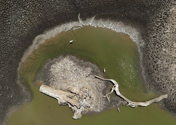
An El Niño-related drought affected nearly 100,000 people in Sri Lanka (Image: Getty)
According to Mr. Willis, the key advantage of altimetry is a 35-year continuous dataset gathered by nearly identical satellites following almost identical orbital paths, with each mission seamlessly overlapping the next.
Data collected through October indicates that the structure of the 2026 El Niño closely resembles that of the 1997 event.
Recent satellite observations show that the 2026 El Niño's ocean structure closely mirrors the 1997 event, displaying a similar sea level tilt, lower in the west and elevated in the east, with warm water stretching all the way to South America. In contrast, the warm water in 2015 did not push as far toward South America.
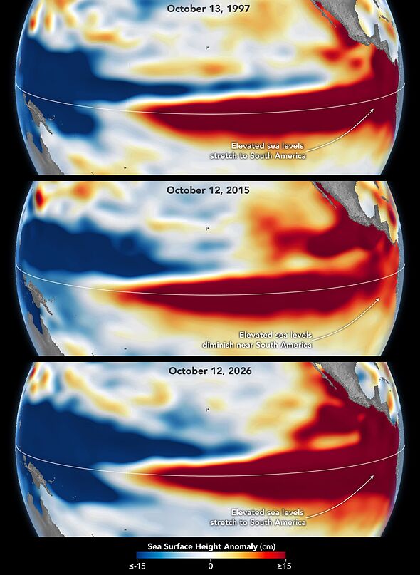
The 2015-16 El Niño was also very strong, as elevated sea levels in October 2015 show (Image: Maps by NASA Earth Observatory/Lauren Dauphin)
These satellite images follow a recent announcement from the World Meteorological Organization (WMO) warning that the Super El Niño is becoming 'unprecedented in strength'.
Data from the latest Global Seasonal Climate Update indicates that sea surface temperatures across the tropical Pacific, the core of El Niño, may exceed average levels by up to 3.8°C between November 2026 and January 2027.
The powerful El Niños are highlighting climate change (Image: Getty)
Despite these remarkable measurements, NASA notes that the exact extent of this winter's full global impacts remains uncertain.
"This is literally off the monitoring charts that we have used for the past four decades," WMO Secretary-General Celeste Saulo said.
She warned, "El Niño will peak towards the end of 2026, but its impacts will be felt long after that."
Source: “AOL Breaking”
